
Software GIS4ALL
GIS Outsourcing
Services
Unconventional Field
Optimizer
About Us
Contact Us
Improve your business processes

GIS Application and Services
Improve your business processes
using
innovative
GIS solutions.

GIS Application and Services
Improve your business processes
using innovative
GIS solutions.
Software GIS4ALL
GIS4ALL was built to help organizations to seamlessly synchronize Corporate Geodatabases
with SAP PM.
GIS4ALL detects new assets or changes in the Enterprise Geodatabase (both versioned and non
versioned
feature classes) that have been previously defined as “relevant for SAP” in a configuration
table
and
inserts a synchronization message accordingly in the Synchronization Framework.

GIS4ALL works together with SAP’s GEO.e/GEF technology empowers the SAP Business Suite with GIS data.
GIS Outsourcing Services
Find out how our GIS outsourcing services can help you decrease labor costs while providing
world-class GIS development and production services within your organization.
We have been successful in deploying complex GIS Applications within sophisticated corporate IT
infrastructure. We have three main services:

Geo Developement
GeoDevelopment of Desktop, Web and Mobile Applications

GeoDBA
Helps to administer and support complex infrastructure
GeoDATA
Services to edit and geoprocess vector and image data
Unconventional Field Optimizer
Software helps oil and gas companies efficiently place well laterals to maximize recovery of
shale
reservoirs.
Using UFO you can maximize recovery of shale reservoir in three simple steps:
Step 1
UFO Constraint Calculator
Define surface constraints based on existing facilities, roads and pipelines; environmentally sensitive areas, rivers and ground slope. Also define subsurface restrictions based on existing wells, fractures and other structures that need to be avoided during drilling.

Step 2
UFO Template Designer
Builds templates containing a single pad, multiple wells, wellhead spacing,
lateral
length, well spacing, fracking schema.
Fine tune your Template to meet your facility and drilling requirements with
interactive editing tools.
Template Designer automatically calculate template drilling cost based on
reference
prices.
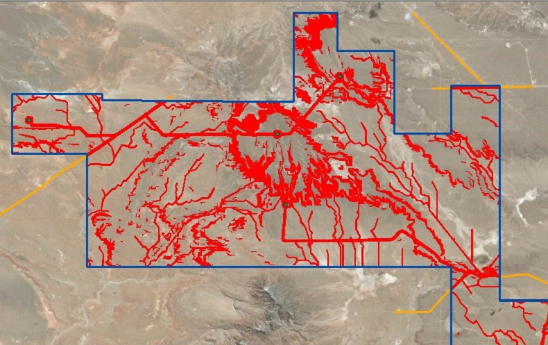
Step 3-1
UFO Optimizer
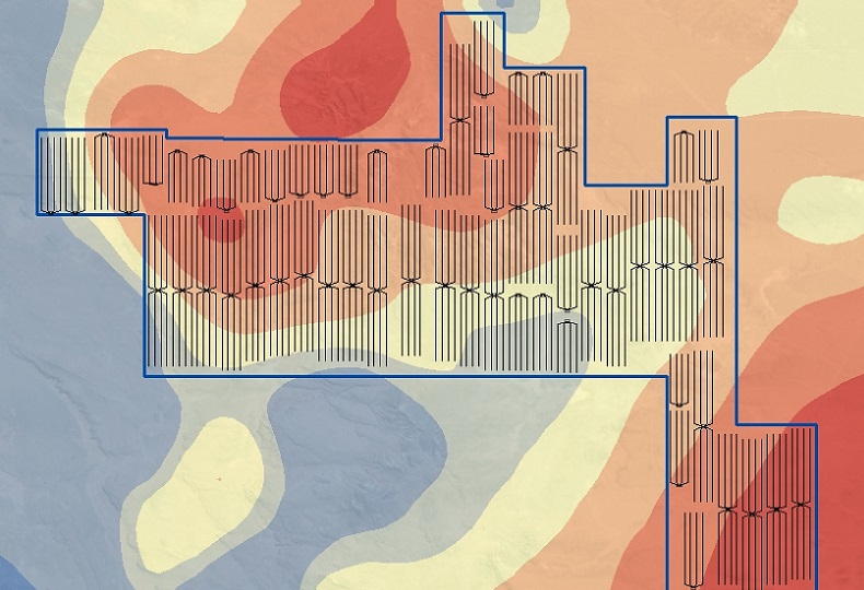
Define reservoir area estimated recovery using original gas in place, original oil in place, total organic carbon or other grids. UFO powerful Integer Linear Programming algorithm will combine different Templates to place well laterals in the field to maximize recovery.
Step 3-2
UFO Optimizer
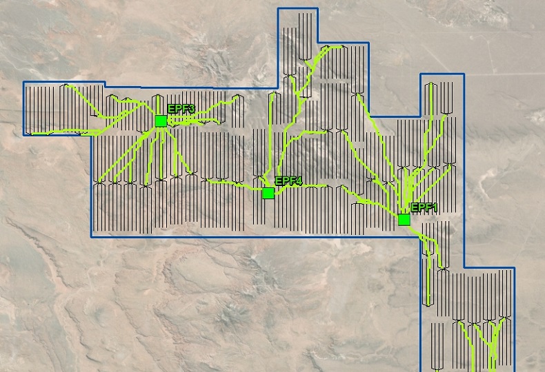
UFO place laterals avoiding subsurface constraints. UFO place pads avoiding surface constraints. UFO includes a pipelines module that helps place production facilities and pipelines in shale operations. Figure below shows K-means Clusterization model followed by CostDistance geoprocessing used to optimize the location of five Early Production Facilities and efficiently trace flowlines.

Step 3-3
UFO Optimizer
UFO Team developed a new algorithm based on well sequencing that is helping shale operators. The model maximizes the objective function "Net Present Value of future production cashflow". Computational results show that this approach may provide an optimization opportunity both in new shale developments and existing developments with infill drilling activities.
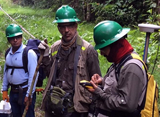
About Us
Team Of GIS Fans
Our software engineers have proven experience in developing, deploying and managing enterprise solutions based on ArcGIS platform:
• Geodatabase and ArcGIS Enterprise
• ArcGIS Desktop and Pro
• Oracle and MS SQL Server
• ArcObjects and REST with .Net and JavaScript
• Android API for Mobile applications
• Integration with Microsoft SharePoint, SAP PM and others.
• ArcGIS Desktop and Pro
• Oracle and MS SQL Server
• ArcObjects and REST with .Net and JavaScript
• Android API for Mobile applications
• Integration with Microsoft SharePoint, SAP PM and others.
Agile Software Development methodology based on SCRUM. Research and Development oriented. Facing challenges in Oil and Gas, Utilities, Pipelines, Land Parcel and Utilities.